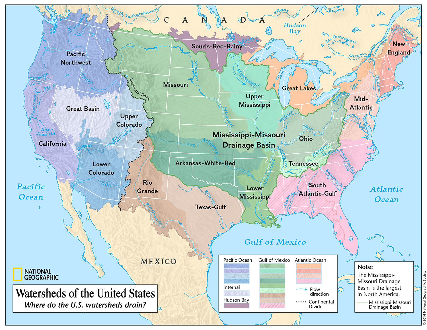
Reply To: Map of Cascadian Soils

  • Paul Cereghino

    Steward
    January 26, 2024 at 4:17 pm

    As you pointed out, scale and purpose will be your revenant. In some of my synthesis work I have been settling on a set of five scales for multi-scale information management three of which might make sense… just ideas, not prescriptions:

    REGIONAL SCALE – 100s of square miles, usually encompassing many large watersheds or marine basins. At this scale just differentiating between parent materials will be useful… parent material describes glacial history, and a wide variety of soil attributes… and lumping parent material makes sense

    WATERSHED SCALE – 10s-100s of square miles, still parent material, but not lumped, but in color families based on geomorphic origin (alluvial all cool, volcanic all warm…)

    LANDFORM SCALE – 1s to 10s of square miles… at the scale of a floodplain reach, tributary, river delta, beach drift cell, etc… at this point you can dive into soil series with color by parent material.

    Some of the coolest soil maps use color blending over lidar hillshade because there is often a correlation between landform and soils series or parent material. WDNR has been in an orgy of lidar lately… https://www.dnr.wa.gov/lidar#comparison-gallery

    Of course you could focus on some other attributes for special purposes… but my two cents for general purpose.
    These could become new baselayer tile services…!!